Table of contents
A short introduction
Death Valley is an endorheic basin in the Mojave Desert, lying almost entirely in the state of California – one of the hottest places on Earth, where in July 1913 the air temperature reached 56.7 °C (still the world record today). Because of the time of year when we visited Death Valley (October), the highest temperature we experienced was “only” 38 degrees. It is also very dry there – rainfall doesn’t exceed 50 mm a year. You might think that a place like this would be mostly desert with few interesting places to see. Nothing could be further from the truth! Death Valley ended up among our top places in the USA!
In the park you’ll find the remains of a salt lake and eroded rock formations (some of them in different colours). The variety is rounded off by sandy deserts and volcanic craters. No wonder several parts of Star Wars were filmed in this otherworldly landscape.
Map
What to see in one day?
Devil's Golf Course

It is a large area covered with countless hard lumps with sharp edges – mixtures of earth, salt and minerals formed after the lake evaporated. Did the devil himself play golf with them?
Badwater Basin

The remains of a salt lake – a huge area made up of an endless expanse of snow-white salt arranged in hexagonal shapes. This is the lowest point in North America ( −85.5 m below sea level), and at the same time the second-lowest in the Western Hemisphere.
Fun fact – the highest mountain in the contiguous United States (excluding Alaska) – Mount Whitney – is only 140 km away.
Artists Palette

An area where you can admire “colourful” mountains. Their rocks have undergone a chemical process that has coloured them in different shades.
You get there along Artists Drive, which is an attraction in itself. Note that the road is one-way and the entrance is from the south – it’s best to go there on your way back from Badwater Basin.
Zabriskie Point


A viewpoint from which you can admire interesting eroded rock formations that create a lunar landscape! If you can, it’s worth coming here at sunrise.
Mesquite Flat Sand Dunes

Sand dunes – some of them really big (the highest, Star Dune, is about 30 metres high). They were formed by the erosion of the mountains to the north, from where the wind blows the sand. The mountains to the south form a barrier that keeps the dune field in place. Scenes for several films were shot here, including Star Wars.
Ubehebe Crater

A huge crater that looks like the site of a meteorite impact, although it was actually created by volcanic activity. Its depth is 237 metres, its width a kilometre, and its age is estimated at around 2–7 thousand years. Close by is also the Little Hebe crater.
Other attractions
Unfortunately, we didn’t get to visit these places.
Racetrack Playa
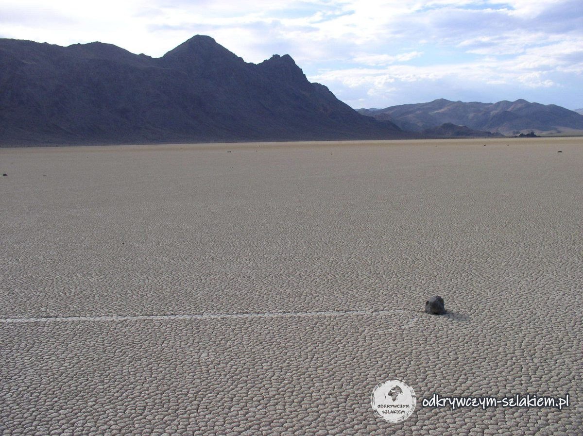
A dried-up salt lake, and above all a place where boulders regularly change their position, although for a long time nobody had seen them move.
Relatively recently, in 2013, researchers were able to observe the phenomenon in detail (the rocks had been fitted with GPS receivers beforehand) and so explain why the rocks move.
The phenomenon requires a rare combination of conditions (source: Wikipedia):
- after heavy rain, the valley floor has to be covered with a layer of water a few centimetres deep, so that a floating layer of ice can form, but not so deep that the water covers the rocks completely;
- on a freezing night, a layer of ice of the right thickness has to form on the surface: too thin and it won’t be strong enough, too thick and the water will freeze to the bottom in places;
- during the day the sun has to warm the ice so that it cracks into large sheets floating on the surface of the water.
We were advised against going there in an ordinary car , but in the end we wouldn’t have had time anyway – at Ubehebe Crater it was already getting dark, so it would have been even more dangerous.
Wildrose Charcoal Kilns

Kilns completed in 1877, used to make charcoal by slow burning with little oxygen. The charcoal was transported to the mines to help with mining/smelting ore. There are 10 of them and they are very well preserved.
Mosaic Canyon
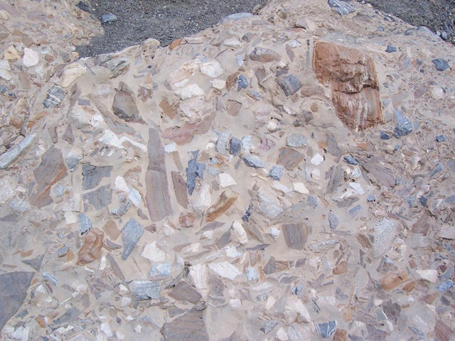
The name comes from the rock formation found there, known as Mosaic Breccia, made up of different kinds of parent rock. The canyon trail is about 6.5 km return – after just 400 metres the path narrows considerably.
Stovepipe Wells

Here you can buy souvenirs in the shop, eat, fill up with very expensive petrol or use some very weak Wi-Fi. But in Death Valley places like this are few and far between (another one is Furnace Creek) , so it’s worth keeping in mind :).
Practical information
- Accommodation: best at a campsite (if you don’t want to spend a fortune) – we can recommend Furnace Creek Campground (website).
- When exploring areas like this, keep in mind certain risks that sometimes make it worth taking a detour of a few kilometres. It’s better to go back by a safer route than, for example, to get your car stuck. On some roads it’s better to drive only an off-road vehicle.
- During the day temperatures are extremely high, but at night it is relatively cold.
- Bear in mind that there is no signal (especially no mobile internet) – so plan your sightseeing in advance and ideally prepare offline maps.
- If you plan Death Valley as part of a longer route, expect a long day behind the wheel – in one day we drove from Zion (from the town of Virgin) through Death Valley all the way to Lee Vining, 859 km in total.
- Take plenty of water with you!
- It’s worth filling up your tank beforehand, because petrol will be expensive!